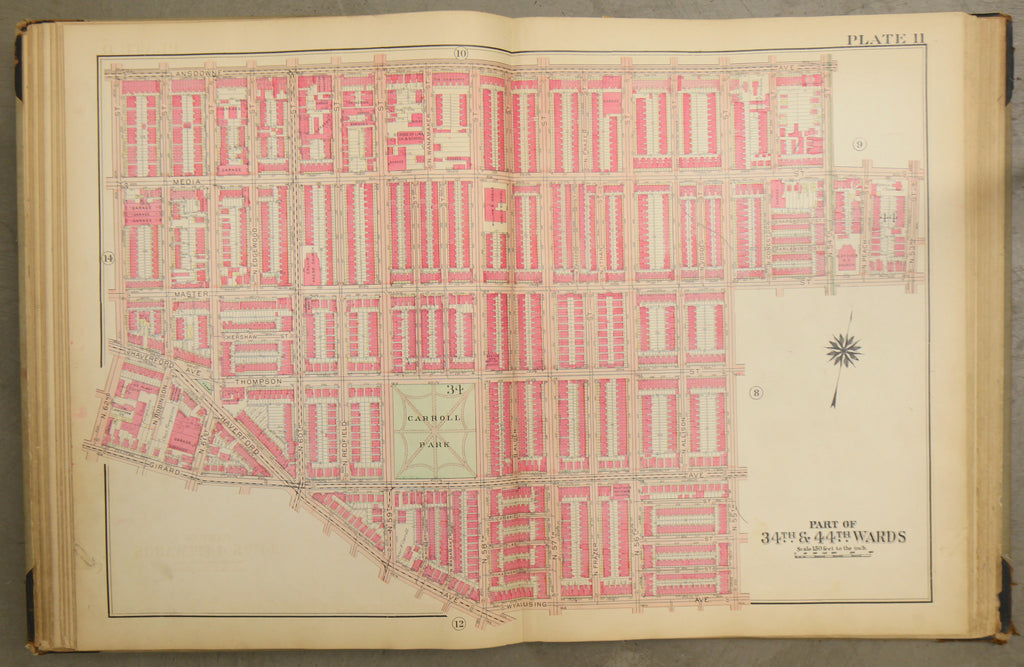
1928 Bromley Atlas -- Haddington/Carroll Park
$ 75.00
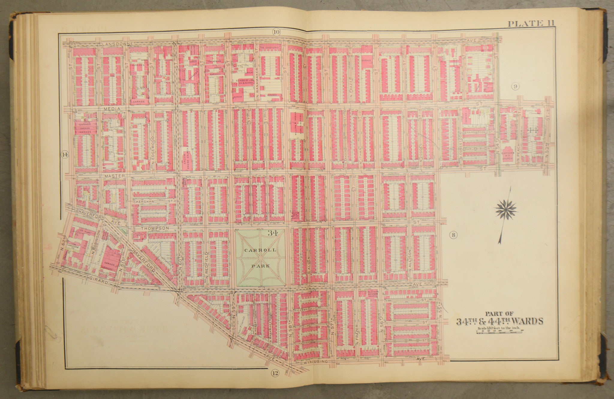
1928 Bromley Atlas - Plate 11 - Carroll Park: Haddington from 55th St. west to 62nd St. and Girard Ave north to Lansdowne Ave between Haverford Ave, Wyalusing Ave, and Girard Ave and the historic William B. Hanna School
Big, beautiful and original! 23 by 33 map of Carroll Park and part of Haddington. The map shows row homes, churches, and factories, as well as Carroll Park itself and the historic William B. Hanna School.
Condition: 2-inch tear from the center of the base, light ghosting, minor soiling, chipping